Precision Distance Measurement in Modern Surveying
Accurate surveying is essential for infrastructure construction, mapping, and geospatial analysis. One of the most important technologies enabling modern surveying workflows is hassas mesafe ölçümü. By combining optical sensing technologies with advanced positioning systems, surveyors can collect reliable distance data in a wide range of environments.
Today, surveying instruments increasingly integrate laser sensors with satellite positioning technologies such as GNSS and optical instruments like total stations. This integration allows professionals to build a high precision distance measurement system capable of delivering stable and repeatable results for engineering projects, land surveying, and industrial measurement tasks.

Understanding Precision Distance Measurement Technology
Precision distance measurement refers to the process of calculating the exact distance between two points using optical or electronic sensing technologies. Unlike traditional tape or mechanical methods, modern systems rely on electronic signals to determine distance quickly and accurately.
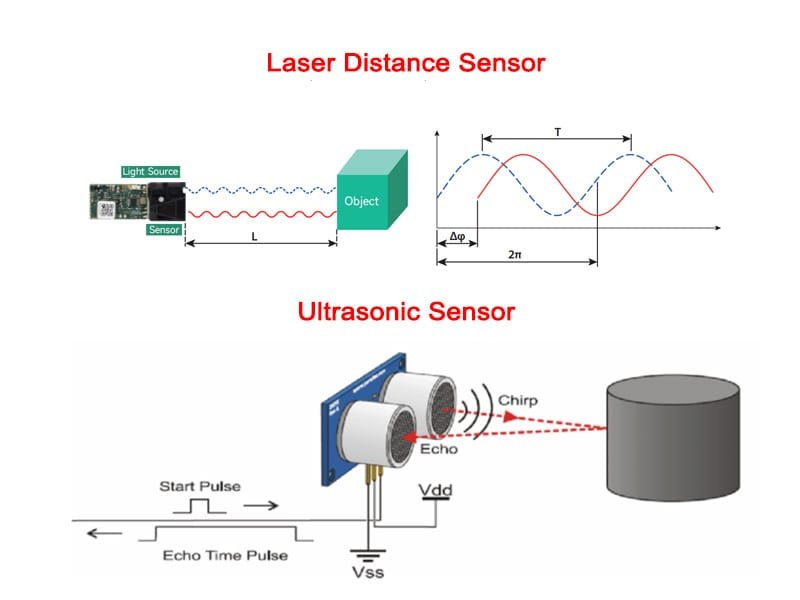
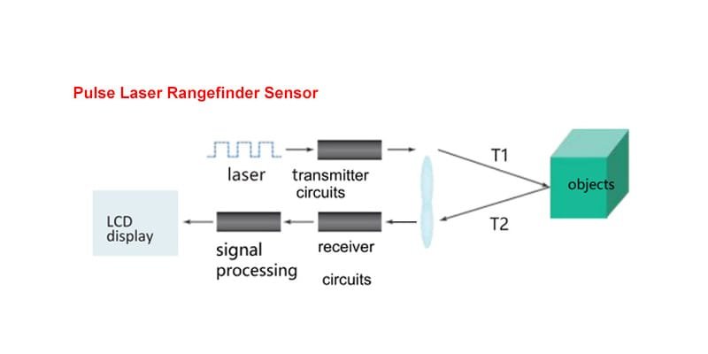
A typical electronic distance measurement sensor operates by transmitting a laser signal toward a target surface and analyzing the reflected light. By calculating the signal’s travel time or phase difference, the system can determine the distance with extremely high precision.
Compared with traditional measurement approaches, these systems provide several advantages:
• Faster measurement speed
• Higher measurement stability
• Improved long-range capability
• Reduced human error
Because of these benefits, electronic optical sensors have become the foundation of modern surveying instruments.
Laser Sensors in Modern Surveying Equipment
Laser sensors play a critical role in achieving reliable hassas mesafe ölçümü. Their narrow beam and strong directionality allow the measurement system to focus precisely on a target, reducing interference from surrounding objects.
Green laser technology has become particularly valuable for field operations. Since green wavelengths are more visible to the human eye than red light, surveyors can identify the measurement point more easily during outdoor work.
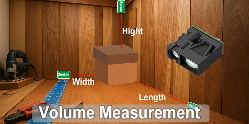
For example, the LDLG-T green laser distance sensor developed for measurement applications supports a detection range of up to 100 metre while achieving an accuracy of approximately 2–3 millimeters. Such performance makes compact sensors suitable for integration into portable surveying devices and advanced electronic distance measurement sensors.
This type of sensor technology provides a reliable foundation for modern surveying instruments.
Integration with GNSS Systems
GNSS technology allows surveying systems to determine the precise geographic position of a measurement point using satellite signals. When combined with hassas mesafe ölçümü, GNSS can significantly improve the efficiency of field data collection.
In many modern surveying workflows, laser sensors are integrated with GNSS receivers to create a unified high precision distance measurement system. This combination allows operators to collect both coordinate and distance information simultaneously.
The benefits of integrating GNSS with laser measurement technologies include:
• Faster data acquisition in the field
• Reduced need for manual calculations
• Improved measurement consistency
• Greater operational efficiency in large areas
These advantages make GNSS-assisted measurement systems widely used in engineering surveys and construction planning.

Total Station Distance Measurement Sensors
A total station distance measurement sensor is one of the most widely used technologies in professional surveying. Total stations combine electronic distance measurement, angle measurement, and onboard computing capabilities into a single instrument.
Inside these devices, a laser-based electronic distance measurement sensor performs the core measurement task. By processing reflected signals, the sensor calculates distance with high stability even over relatively long ranges.
Total stations equipped with advanced sensors provide several capabilities that improve surveying workflows:
• High-accuracy distance measurement
• Automatic target tracking
• Efficient data storage and processing
These systems play an essential role in modern surveying projects, particularly when precise alignment and positioning are required.
Advantages of High Precision Measurement Systems
A modern high precision distance measurement system brings several important improvements to surveying operations.
First, measurement accuracy is significantly enhanced. Laser-based sensing technologies allow systems to achieve millimeter-level performance in many applications.
Second, automation improves efficiency. Integrated electronic distance measurement sensors can perform repeated measurements rapidly, enabling surveyors to collect large datasets in a short period.
Third, system integration simplifies field operations. By combining GNSS receivers, laser sensors, and total station distance measurement sensors, survey teams can rely on a single coordinated measurement platform.
Together, these improvements reduce operational complexity and improve the reliability of measurement results.

Surveying Applications
Today, hassas mesafe ölçümü technology is used in a wide variety of professional fields.
In construction engineering, measurement systems help verify structural alignment and ensure that building components meet strict dimensional requirements.
In land surveying and mapping, integrated systems allow surveyors to collect terrain and boundary data efficiently. GNSS-assisted measurement platforms make it possible to perform surveys across large geographic areas.
Infrastructure development projects such as transportation networks and urban construction also rely heavily on total station distance measurement sensors to obtain accurate spatial data during planning and implementation.
These technologies enable surveyors to complete complex measurement tasks with greater confidence and precision.

Future Trends in Surveying Technology
Advances in laser sensing and semiconductor technology are continuing to improve hassas mesafe ölçümü solutions. Modern sensors are becoming smaller, more energy-efficient, and easier to integrate into various surveying instruments.
Compact modules such as the LDLG-T laser sensor, with its 100-meter measurement capability and millimeter-level accuracy, demonstrate how miniaturized components can support professional measurement systems.
In the future, integrated platforms combining GNSS, laser sensors, and automated data processing will further transform surveying workflows. These systems may also be incorporated into mobile mapping devices, drones, and smart infrastructure monitoring platforms.
Sonuç
Modern surveying increasingly depends on reliable hassas mesafe ölçümü technologies. By integrating laser sensors with GNSS positioning systems and total stations, engineers can build highly efficient measurement platforms capable of delivering accurate spatial data.
With continued development in electronic distance measurement sensors, advanced surveying equipment will provide even greater accuracy and flexibility for geospatial professionals. These innovations will continue to support infrastructure development, land management, and engineering projects around the world.
What is precision distance measurement?
Precision distance measurement is a technology used to accurately determine the distance between two points using optical or electronic sensors, commonly used in surveying, construction, and engineering.
How does an electronic distance measurement sensor work?
It sends a laser signal to a target and measures the reflected light. The system calculates distance by analyzing the signal travel time or phase difference.
Why are laser sensors used in surveying?
Laser sensors provide narrow beams and stable signals, enabling more accurate and reliable distance measurement compared with many traditional sensing technologies.
What is a total station distance measurement sensor?
It is the core component in a total station instrument that measures distance using optical signals while the device records angles and position data.
Why are green laser sensors useful for surveying?
Green laser beams are more visible outdoors, helping surveyors locate targets quickly while maintaining accurate distance measurement.