Laser Range Finder Sensor for UAVs: Precision Distance Measurement for Aerial Applications
Overview:
The primary role of a laser range finder sensor in UAVs (unmanned aerial vehicles) is to measure the distance between the drone and the ground or obstacles, ensuring flight safety and precise positioning. With high accuracy, long measurement range, and lightweight design, these sensors are widely applied in terrain mapping, infrastructure inspection, agricultural monitoring, and logistics delivery.

Content:
1. Introduction: Enhancing UAV Applications with Laser Distance Technology
As UAV technology evolves, the laser range finder sensor has become essential for aerial operations. Accurate distance measurement during flight ensures safety, prevents collisions, and enhances operational efficiency. These sensors, with their compact size and high precision, play a critical role in surveying, inspections, agriculture, and logistics.

2. Applications in Terrain Surveying and Mapping
Low-Altitude Flight Control
A laser range finder sensor helps drones maintain stable flight altitude over complex terrains by precisely measuring the ground distance. Unlike GPS, laser-based distance measurement is highly accurate in confined spaces and unaffected by signal interference.
Terrain-Following Flight
For topographic mapping, drones equipped with laser rangefinder sensors can measure real-time ground height variations, allowing automatic altitude adjustments. This terrain-following mode is particularly useful in mountains and valleys, improving data collection accuracy.
Obstacle Avoidance
By continuously scanning the surroundings, laser range finder sensors help drones detect obstacles such as trees, buildings, and power lines, enabling precise maneuvering and reducing the risk of crashes.
3. Infrastructure Inspection Applications
Power Line and Tower Inspections
Drones inspecting power lines, communication towers, and bridges rely on laser range finder sensors to maintain a safe distance, avoiding collisions while ensuring stable data collection.
Wind Turbine Inspections
Wind turbines require routine inspections, and drone laser rangefinders help maintain stable positioning near rotating blades, ensuring detailed structural analysis.
Structural Health Monitoring
With laser-based distance measurement, drones can perform precise structural inspections on bridges, dams, and industrial sites, identifying deformations or cracks that may not be visible to the naked eye.
4. Precision Monitoring in Agriculture
Monitoring Crop Height and Growth
Laser rangefinder sensors enable drones to measure crop height, providing growth data for precision farming, irrigation optimization, and yield improvement.

Topography Monitoring and Aerial Spraying
By ensuring drones maintain a consistent height over crops, laser range finder sensors enable precise pesticide or fertilizer application, preventing over- or under-spraying.
Soil Surface Analysis
Drones equipped with laser sensors can also analyze soil conditions by detecting variations in terrain elevation, allowing farmers to optimize planting strategies and reduce soil erosion risks.
5. Logistics and Emergency Response Applications
Autonomous Landing and Precise Delivery
For drone-based logistics, laser rangefinder sensors ensure accurate altitude detection for safe and precise package deliveries. This is particularly useful in GPS-denied environments.
Emergency Situations and Rescue Operations
Drones equipped with laser range finder sensors aid in disaster response by mapping terrain, detecting obstacles, and delivering medical supplies to remote areas.
Search and Rescue Missions
By integrating laser sensors, drones can efficiently scan large areas, assisting search teams in locating missing persons in forests, mountains, or disaster zones.
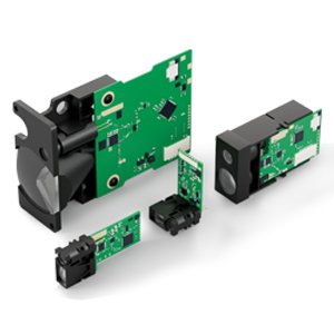
7. Product Recommendations: High-Performance Laser Range Finder Sensors for UAVs
For UAV applications requiring long-range, high-precision laser distance measurement, we recommend:

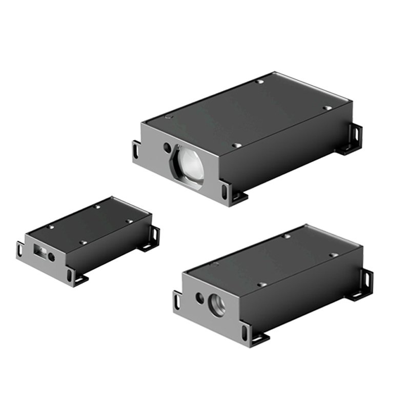
TC25 1500m Laser Range Finder Sensor
- Measurement Distance: Up to 1500 meters
- Precision: 0.5-1m
- Compact & Lightweight: Easy integration into UAV systems
- Ideal for: Drones used in surveying, security, and obstacle detection
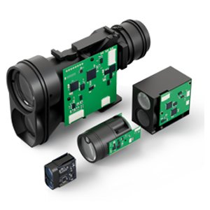
TS1224 2000m TOF Laser Distance Sensor
- Measurement Distance: Up to 2000 meters
- Precision: 0.5-1m
- Rugged and Reliable: Suitable for UAVs in challenging environments
- Ideal for: Night vision, thermal imaging, and military UAV applications
8. Conclusion: Advancing UAV Capabilities with Laser Distance Technology
The laser range finder sensor has become a crucial component for UAV applications, enabling precise distance measurement, obstacle detection, and automated flight control. Whether used for surveying, inspections, agriculture, or logistics, these sensors enhance safety, efficiency, and accuracy. As UAV technology continues to advance, high-accuracy laser rangefinder sensors will play an even greater role in intelligent aerial operations.
More Solutions